Cloth Backing Removal
The artist drew the 1758 map using graphite pencil, iron-gall ink, and about 14 watercolor paints on three sheets of medium-weight, gelatin-sized, handmade laid paper, adhered together with a slight overlap to form the panorama format. Originally, the paper was likely cream in color and the colors more brilliant.
1 of 4
-
The right third of the map, before treatment in raking light. Note the overall brown tone, lack of image contrast and clarity, the original paper overlap near the left edge, and the deformations especially along the perimeter due to interlayer tensions in the original 18th century paper, the silk, the lining paper, and the cloth backing.
-
The cloth backing, with now-visible brush marks in the adhesive (the adhesive used to attach the cloth backing to the map discolored over time)
-
Under ultraviolet light, the brush strokes are even more visible
-
Releasing the cloth backing, dry, using a Teflon spatula


Silking and Paper Lining Removal
Unlike the cloth backing, the silking and paper lining could be removed only with the help of water. Extensive preparation for wetting the map included testing the solubility of the silking and lining adhesive(s) and of all inks and watercolors. The adhesive tested strongly positive for starch and weakly positive for protein and was readily solubilized with an alpha-amylase enzyme solution; testing suggested all media were stable in water and in ethanol.
1 of 5
-
Before pouring on the alpha-amylase solution, the object was humidified in a Gore-Tex sandwich and then misted with a 1:1 mix of water and ethanol, which makes it safer to inundate the object with water
-
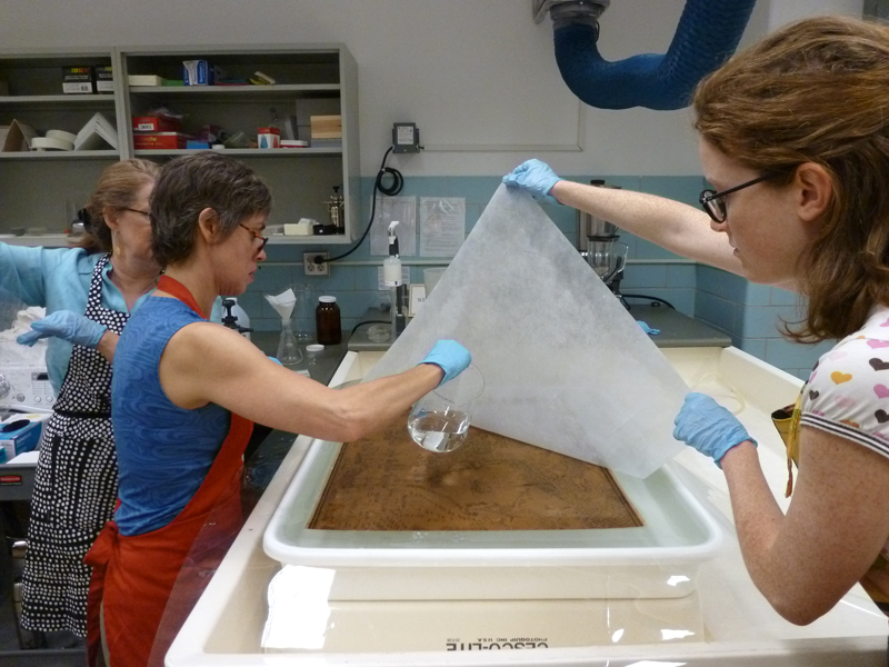
After a few minutes, the enzymes have digested the silking and paper lining adhesive, and the paper lining comes off readily
-
A long, open tear and staining visible upon removal of the paper lining from the back of the map
-
Removing the silking from the front of the map
-
Brushing away any remaining adhesive residue; after thorough rinsing, the map was dried between wool felts


Structural Mending
Removal of the silking and of the paper lining and cloth backing revealed tears and losses in the original 18th century paper. Tears were mended and losses were filled from the back side of the map. Then each third was lined with Korean paper. The lining provides further structural support to the original map paper.
1 of 5
-
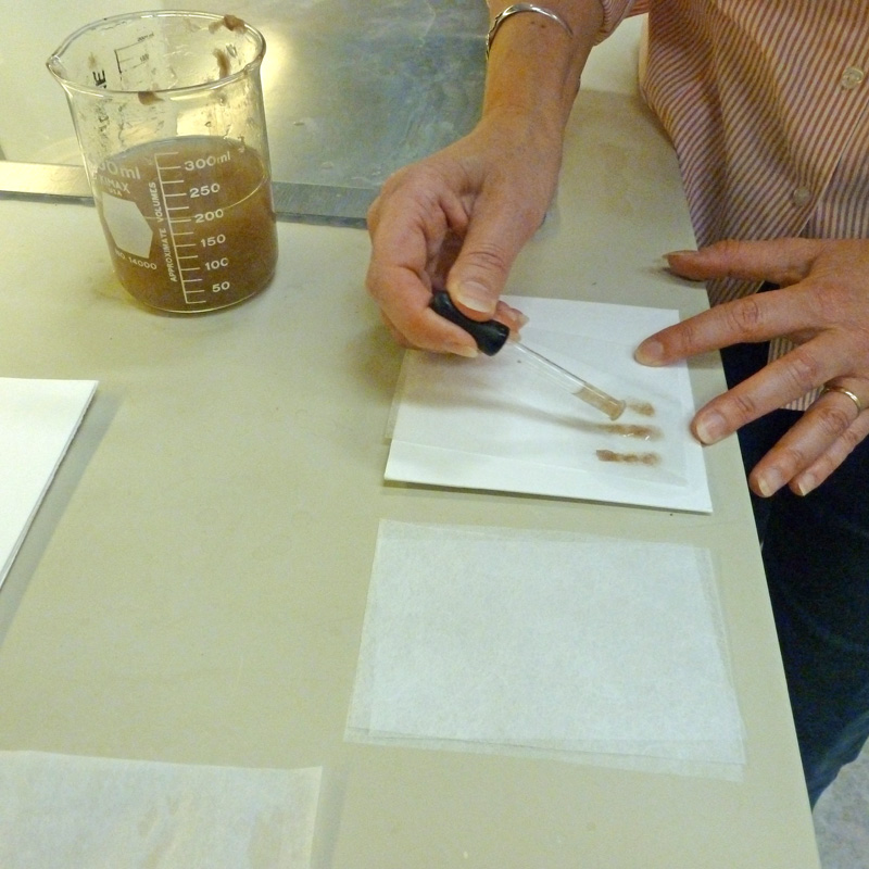
Paper pulp, custom made in the lab to an appropriate strength and color, is squeezed out of an eyedropper into small strips; when dry, the strips will be used on the back side of the map to mend tears
-
Filling losses, from the back side of the map, with wet paper pulp custom made in the lab to an appropriate strength and color
-
Brushing gelatin sizing (very dilute, purified animal glue) onto the map; sizing helps strengthen the paper
-
Lining the map: Pasting Korean paper onto the back side of each third of the map
-
After lining, the map panels dry between wool felts and under heavy weight to ensure a good bond between the map and the lining paper


Visual Integration
Because the Library’s Geography and Map Division has storage to accommodate the large map flat and unfolded, the three panels of the map were rejoined.
1 of 4
-
Where necessary, additional mends were visually integrated onto the front side of the map
-
Using pastels to further refine the color match of the dried pulp fills
-
The three panels of the map were attached to each other using the excess Korean lining paper along the join edge
-
The excess lining was trimmed to about 2 inches wide, then cut and adhered in a dovetail pattern


 Enlarge